Build real GPR training confidence with hands-on instruction and support from GPR USA. Strengthen field performance today.
Explore concrete x-ray differences with GPR USA and learn how scanning methods affect safety, accuracy, and jobsite efficiency.
Should you buy GPR, rent GPR, or hire help for utility locating? Compare GPR for utility locating with GPR USA.
Learn the top uses of GPR construction scanning to improve safety, avoid hits, and plan accurately with experts at GPR USA.
GPR USA explains how accurate subsurface mapping with GPR is, helping crews understand depth, precision, and factors that influence reliable underground data.
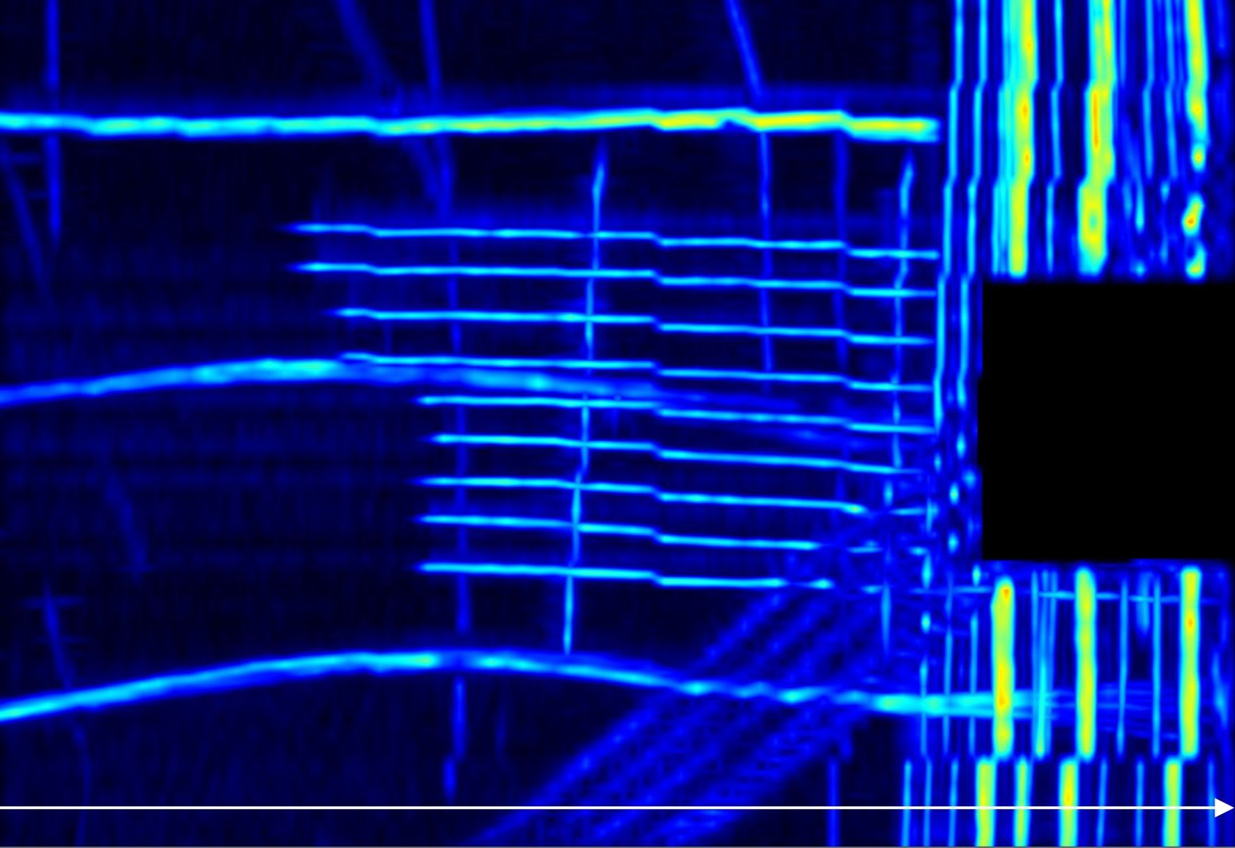
GPR USA explains what GPR can find, helping crews identify underground materials, utilities, and features for safer, more accurate field decisions.
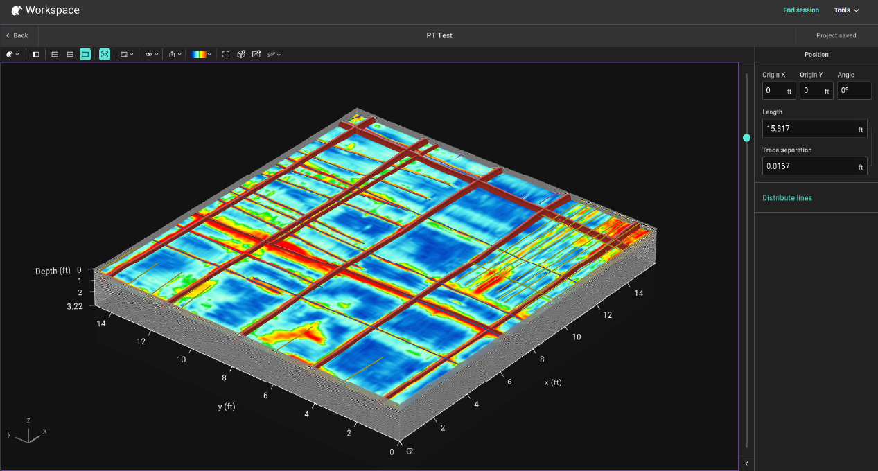
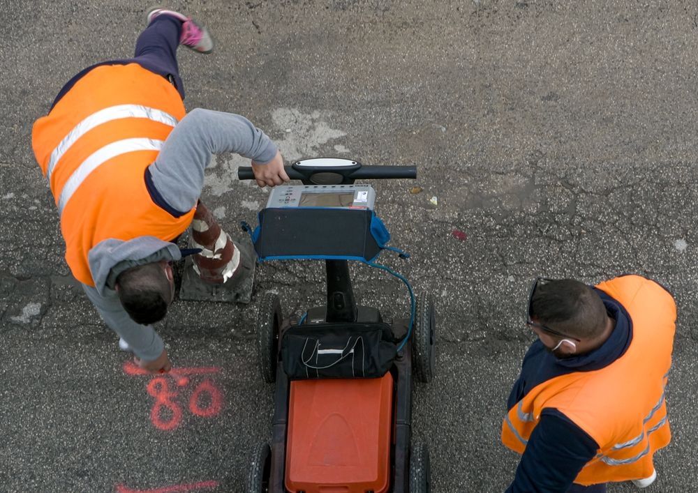
Learn what underground utility mapping is, how GPR detects buried utilities, and why accurate mapping prevents strikes, delays, and safety risks.
Explore Ground Penetrating Radar (GPR) costs, factors that impact pricing, and how investing in your own system can save time, money, and delays.
Discover how deep Ground Penetrating Radar (GPR) scans in concrete, soil, and geological surveys, plus the factors that affect penetration depth.
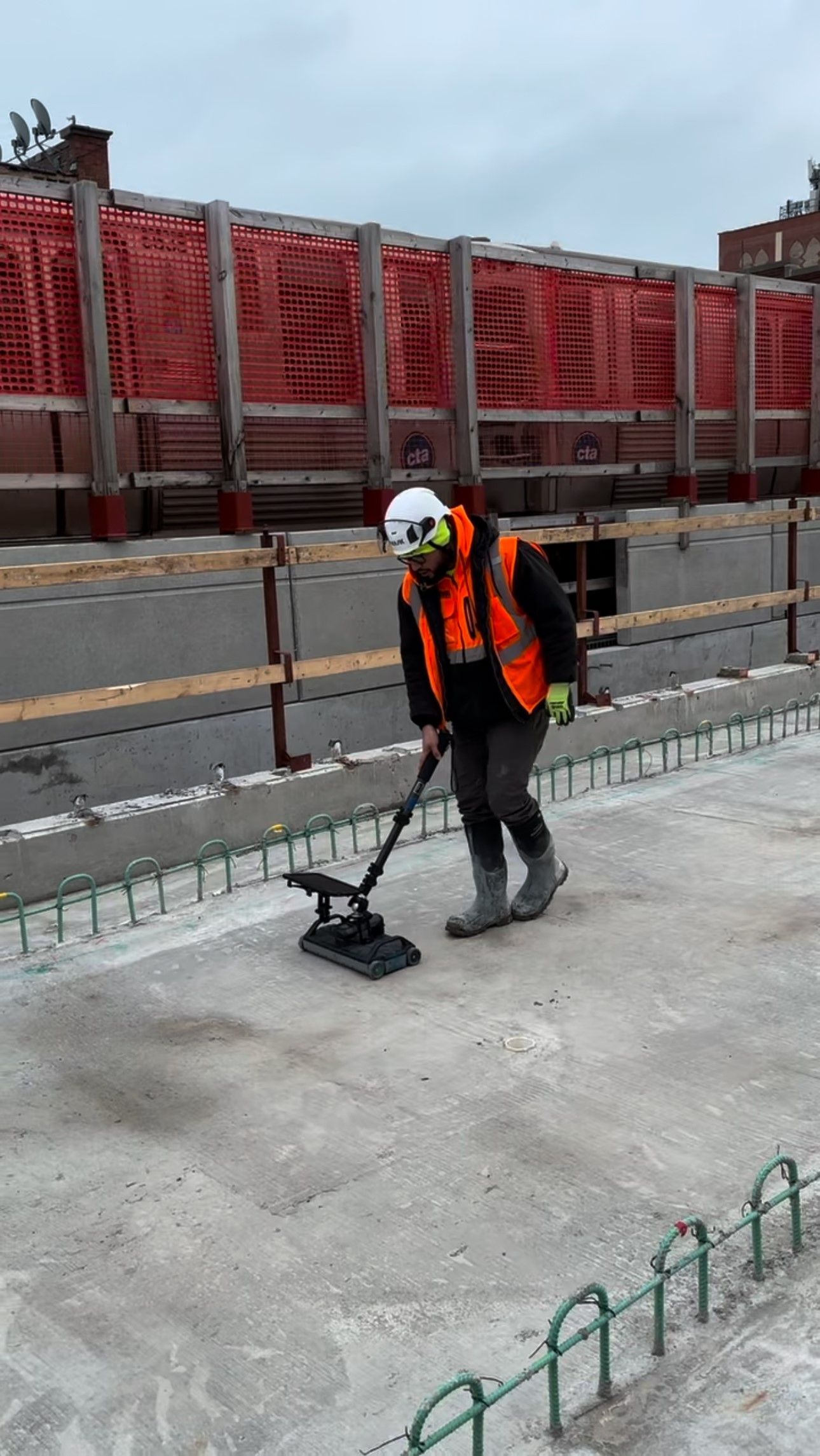
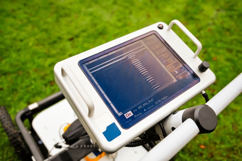
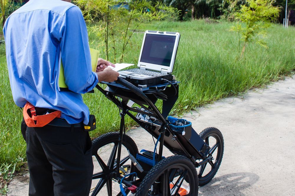
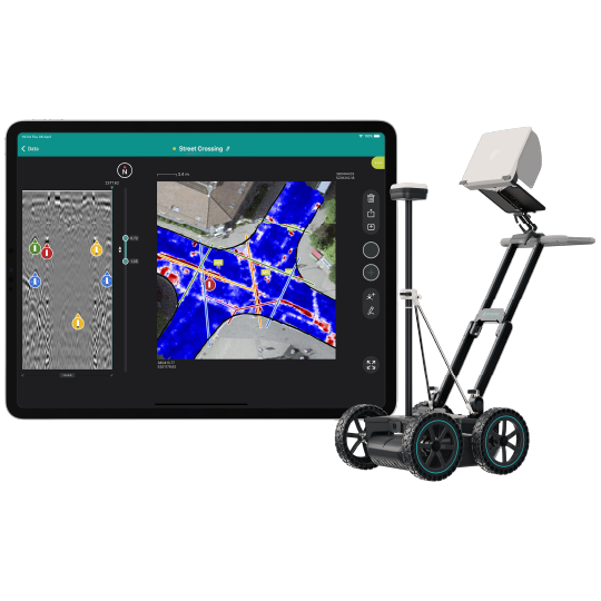
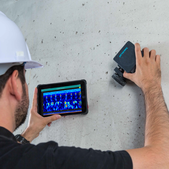
Learn how Ground Penetrating Radar (GPR) works, its applications in concrete scanning, utility locating, and geotechnical work, plus the benefits of owning GPR.