Handheld vs. Cart-Based GPR Systems: Which One Do You Need?

May 15, 2026

Share this Article:

Person using a black-and-orange ground scanner on a paved surface

Concrete scanning setups often get decided in the rush of project timelines. One crew rolls in with a compact unit for quick checks, while another maps out large areas with a full cart system. Both get results, but not always with the same efficiency or clarity. That gap can lead to missed details or wasted time. Choosing the right ground penetrating radar setup starts to matter more as job complexity increases, especially when avoiding hits is on the line.

Why Your GPR Setup Matters on the Job Site

Job conditions rarely stay predictable. One day calls for tight interior scans, the next for wide-area mapping across open ground. That’s where the right ground penetrating radar (GPR) setup starts to shape outcomes. Different tools handle depth, coverage, and mobility in their own ways, and those differences show up quickly in the field. Across the many industries that rely on GPR scanning, crews are balancing speed with accuracy while trying to avoid hits. The setup behind the scan often decides how smoothly that balance holds, especially when timelines are tight and site conditions start to shift.

Handheld GPR Systems: Compact and Jobsite Flexible

Handheld systems are built for mobility and quick decision-making in the field, especially when scanning concrete or working in tight, hard-to-reach areas.

What Is a Handheld GPR Scanner?

A handheld GPR scanner is a compact ground penetrating radar unit designed for close-range subsurface imaging. It’s typically used directly on concrete surfaces to locate rebar, conduits, and post-tension cables before cutting or drilling, helping crews avoid hits in active jobsite conditions.

Key Advantages of Handheld GPR

Handheld systems are built for speed and control in tight jobsite conditions, often used for precise concrete scanning tasks.

  • Easy to carry and quick to set up
  • Works well in confined or interior spaces
  • Real-time subsurface imaging for fast decisions
  • Helps avoid hits before cutting or coring
  • Simple operation with jobsite-ready Screening Eagle scanners

Limitations to Consider

Handheld GPR works best in specific conditions, with a few trade-offs to keep in mind.

  • Limited depth compared to larger cart systems
  • Slower coverage on larger scan areas
  • Results can vary with operator experience
  • Less efficient for full-site subsurface mapping
  • May miss broader patterns across larger survey zones

Best Use Cases

Handheld units are widely used for GPR in construction projects, especially when scanning concrete before cutting or drilling. They’re a strong fit for interior work, slab inspections, and targeted scans where access is limited and quick, accurate subsurface imaging helps crews avoid hits.

Cart-Based GPR Systems: Built for Coverage and Depth

Cart-based systems are designed for larger scan areas, where consistent data collection, deeper penetration, and efficient coverage matter more than tight access or mobility.

What Is a Cart-Based GPR System?

A cart-based GPR system is a ground penetrating radar setup mounted on a wheeled platform, designed for scanning larger areas. It’s commonly used for underground utility mapping, road surveys, and subsurface imaging where consistent data collection and broader coverage are needed.

Key Advantages of Cart Systems

Cart-based systems are designed for efficient, consistent scanning across larger areas.

  • Covers large scan areas quickly with consistent results
  • Greater depth penetration for deeper targets
  • Multi-channel arrays improve data density and clarity
  • Ideal for mapping utilities and subsurface features at scale
  • Supports detailed imaging for planning and documentation

Limitations to Consider

Cart-based systems offer strong coverage, with a few practical limitations on active job sites.

  • Less maneuverable in tight or congested areas
  • Longer setup time than handheld units
  • Higher cost and more equipment to manage
  • Not ideal for quick, targeted concrete scanning
  • Requires more space for consistent movement

Best Use Cases

Cart-based systems are commonly used on large sites where coverage and consistency matter. They’re a strong fit for roadway scans, utility mapping, and open-area surveys where teams need reliable subsurface imaging across wide sections without slowing down progress.

Handheld vs. Cart-Based GPR: Side-by-Side Comparison

When comparing handheld vs cart GPR, the differences come down to mobility, coverage, and how the data is collected in the field. Each system fits a different type of workflow, and understanding those tradeoffs helps crews choose the right tool for the task at hand.

Feature Handheld GPR Cart-Based GPR
Mobility High, easy to carry Limited, wheeled system
Coverage Small, targeted areas Large, continuous scans
Depth Moderate Greater depth range
Setup Time Minimal Longer setup required
Best For Concrete scanning Utility mapping, large sites

How to Choose the Right GPR System for Your Work

Choosing the right system starts with the type of work being done and the on-site conditions. Smaller, detail-focused tasks like concrete scanning often call for handheld units, while large-area surveys tend to use cart-based systems. Depth requirements, access limitations, and how fast data needs to be collected all factor into the decision. Teams also think through workflow. In some cases, it makes more sense to buy, rent, or hire a pro depending on how often the equipment will be used. The right choice keeps projects moving while reducing the risk of costly hits.

Why Many Professionals Use Both

On active job sites, no single system covers every scenario. Many teams keep both handheld and cart-based GPR in their workflow to stay flexible. A handheld unit handles quick concrete scans and tight spaces, while a cart system covers larger areas with consistent data. This combination helps crews move efficiently between tasks without compromising accuracy. It also reduces the chances of missed targets when conditions shift, keeping projects on track and helping avoid hits across different phases of work.

GPR USA’s Approach: Tools, Training, and Real Support

GPR USA works with professionals who need reliable results in the field, not guesswork. Their lineup includes jobsite-ready scanners along with concrete structure products and subsurface mapping products built for real conditions. Beyond equipment, their team focuses on practical GPR training and responsive repair services so crews stay up and running. From first scan to ongoing use, GPR USA stays involved where it counts, helping teams work safely, efficiently, and with greater confidence on every job. 


If you’re looking to strengthen your scanning workflow,
contact us for more information and connect with a team that understands real jobsite challenges.

Two construction workers in neon jackets and hard hats walking through a large building site

Share with Us!

A close-up view of a ground-penetrating radar display screen mounted on a cart, set against a green grass background.
March 12, 2026
Explore the top industries for GPR scanning, from construction to infrastructure inspections. Learn how GPR USA helps teams detect hidden subsurface risks.
Group of men with surveying equipment near a white van, outdoors.
February 26, 2026
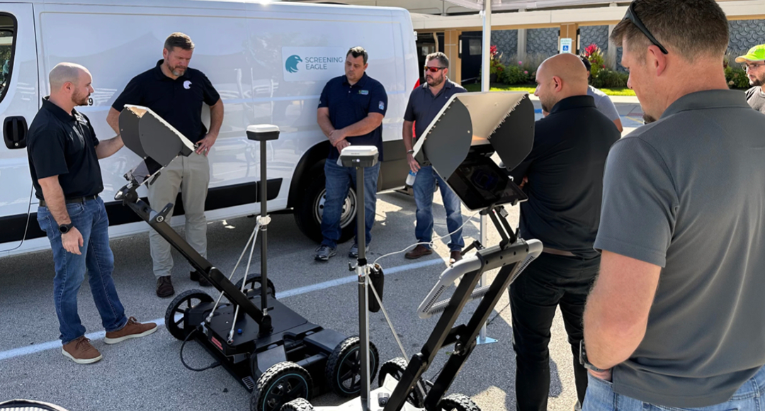
Build real GPR training confidence with hands-on instruction and support from GPR USA. Strengthen field performance today.
Man using ground-penetrating radar on a cart outdoors. He's wearing blue and black, with a laptop open.
February 18, 2026
Explore concrete x-ray differences with GPR USA and learn how scanning methods affect safety, accuracy, and jobsite efficiency.
Two people in orange vests using ground-penetrating radar on asphalt, marking the ground.
January 9, 2026
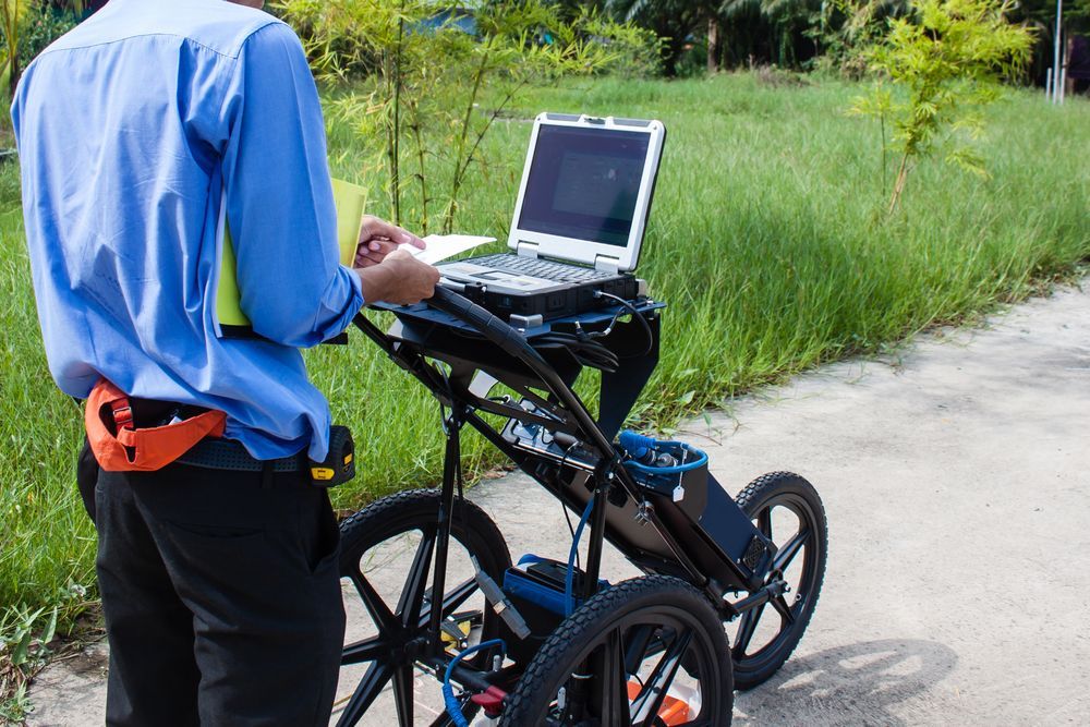
Should you buy GPR, rent GPR, or hire help for utility locating? Compare GPR for utility locating with GPR USA.
Tablet displaying underground utility map with a GPR cart.
January 8, 2026
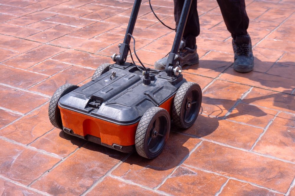
Learn the top uses of GPR construction scanning to improve safety, avoid hits, and plan accurately with experts at GPR USA.
A cart-like device on a paved road, possibly for ground surveying; it has a computer, sensors, and is surrounded by cars.
November 18, 2025
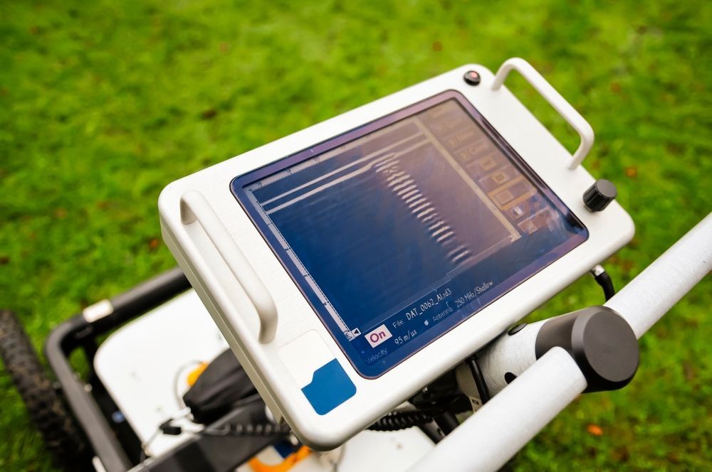
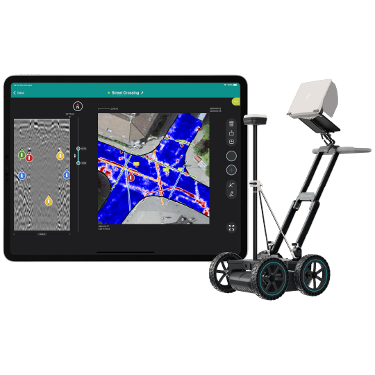
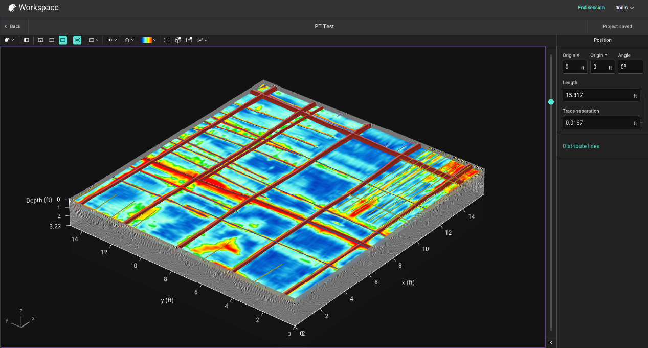
GPR USA explains how accurate subsurface mapping with GPR is, helping crews understand depth, precision, and factors that influence reliable underground data.
Person operating ground-penetrating radar on an asphalt road, device on wheels, red markings.
November 17, 2025
GPR USA explains what GPR can find, helping crews identify underground materials, utilities, and features for safer, more accurate field decisions.
3D rendering of a surface scan with a grid pattern. Color gradients indicate variations, with red representing highs and blue representing lows.
By GPR USA September 15, 2025
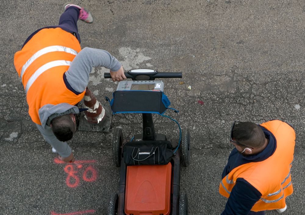
Learn what underground utility mapping is, how GPR detects buried utilities, and why accurate mapping prevents strikes, delays, and safety risks.
Construction worker using device on wall, viewing display on tablet.
By GPR USA September 12, 2025
Explore Ground Penetrating Radar (GPR) costs, factors that impact pricing, and how investing in your own system can save time, money, and delays.
Blue and white spectrogram of sound waves, showing frequency and amplitude over time, with horizontal and vertical lines.
By GPR USA September 10, 2025
Discover how deep Ground Penetrating Radar (GPR) scans in concrete, soil, and geological surveys, plus the factors that affect penetration depth.
Show More